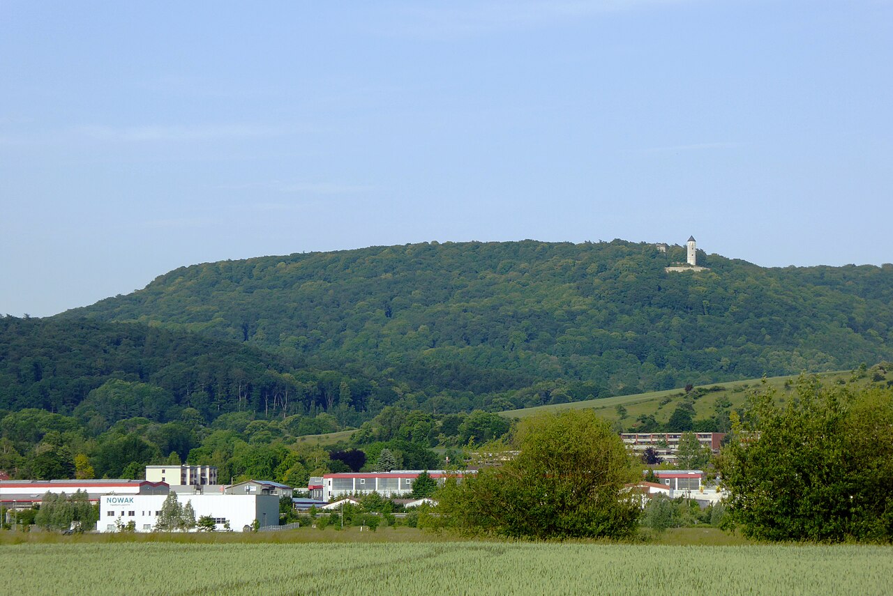
📷 Image: Jan Stubenitzky (Dehio) · CC BY-SA 3.0 · Wikimedia Commons
Göttingen Forest
The Göttingen Forest is a ridge of hills reaching up to 427.5 metres in the Central Uplands of Germany. It lies east of Göttingen city in South Lower Saxony, part of the Lower Saxon Hills. The forest forms one section of the larger Göttingen-Northeim Forest, alongside the Nörten and Reinhausen Forests. To the north and east it borders steep hillsides, while the Harz Mountains begin a few kilometres to the northeast. The forest stretches south of the Rodebach valley and north of the Garte and Bramke valleys, with the Seeburger See lake a short distance to the west. The geology of the area is dominated by layers of middle Triassic Muschelkalk limestone. Plateau-like sections in the north and east show Lower Muschelkalk, while central and western parts contain Upper Muschelkalk formations. Sandstone borders the forest to the north, east and south, and Keuper troughs appear in the Lange Nacht region. Old quarries in the limestone supplied building material for nearby settlements. The thin soils on limestone led to settlements being built mainly where Middle Muschelkalk and small springs occur. Visitors find a varied landscape of separate woods and steep hillsides. The highest areas include the Plessforst plateau near Plesse Castle and the Mackenröder Spitze ridge. The Reinhausen Forest to the south holds Europe’s largest group of rock overhangs, formed by erosion in sandstone ravines. Many old quarry sites remain visible, and the forest edges give views toward the Harz Mountains and the Leine valley meadows. Paths wind through the woods and along the valleys of streams like the Lutter and Braten.
Opening hours and admission prices change with the season and are therefore not part of this text. Current details from the operator
Discover more in this region
Themes around Lower Saxony


Nearby
- Mackenröder Spitze281 m
- Museum auf dem Gutshof2.3 km
- Waake2.7 km
- Hünstollen5.0 km
- Negenborn spring5.3 km
- Roringen4.1 km
QR-Code