📷 Image: Wikimedia Commons
Glen Croe
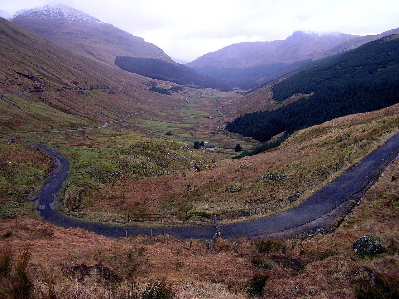
Glen Croe lies deep in the Arrochar Alps of Argyll and Bute, a steep-sided valley where Croe Water rushes down from the mountains to Loch Long. The glen is framed by six rugged peaks, the highest being Beinn Ìme at over a thousand metres, while Ben Donich and the Cobbler rise close behind. A single-track military road runs along the floor, flanked by great boulders left by ancient glaciers. The A83 trunk road climbs above, offering a high-level view of the glen and its rushing burn. At the western end stands the famous viewpoint called Rest and Be Thankful, named for a steep climb on the old military road. The glen has long been a gateway for travellers heading west, first as a military route built in the 1740s under Major William Caulfeild. A stone bearing the words Rest and Be Thankful was set into the hillside around 1749 to mark the end of the steep pull. From 1906 to 1970 the pass hosted motor races, including hill climbs that drew crowds to its sharp bends. A Gaelic song written in 1914, Òran Ghlinne Chrò, laments the loss of sheep grazing when the glen was turned over to deer and sport hunting. Visitors walk the old military road or follow paths beside Croe Water, where cascades tumble over rocky lips. The Cobbler’s jagged silhouette dominates the skyline, while Beinn Luibhean and The Brack rise on either side. At the head of the glen the viewpoint looks down the full length of the valley to Loch Long. The unstable slopes still shift after heavy rain, sometimes closing the main road and forcing traffic onto the lower military track.
Opening hours and admission prices change with the season and are therefore not part of this text. Current details from the operator
Discover more in this region
Themes around Schottland
All themes in Schottland →
Nearby
- The Cobbler1.4 km
- The Brack1.6 km
- Beinn Narnain2.9 km
- Arrochar Alps4.0 km
- Beinn Luibhean3.7 km
- Beinn Ìme4.1 km
QR-Code