📷 Image: Wikimedia Commons
Tuxertal
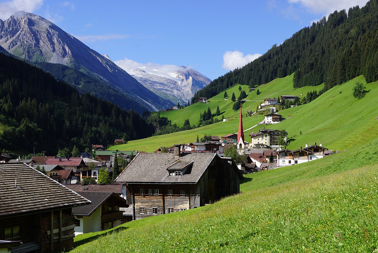
The Tuxertal is a steep Alpine valley in western Austria’s Tirol, branching off the Zillertal near Mayrhofen. It stretches roughly thirteen kilometres from the valley floor at Mayrhofen up to the Hintertux Glacier at the head. The Tuxer Straße climbs through five villages, each perched between eight hundred and fifteen hundred metres above sea level. The Tuxbach stream rises near the glacier and flows down to join the Ziller at Mayrhofen. At the valley’s far end stands the glacier, one of the few in the Alps accessible by cable car. The valley is the only road route to the Hintertux Glacier, making it a key destination for skiers and mountaineers. Hintertux village itself sits at fifteen hundred metres, while the glacier’s lifts start even higher on the mountain. The road passes through Madseit, Juns, Tux and Vorderlanersbach, each offering guesthouses and alpine inns. Finkenberg, the lowest settlement at eight hundred and forty metres, marks the valley’s entrance from the Zillertal. The contrast between the green lower slopes and the ice of the glacier gives the valley its distinctive character. Visitors find a quiet mountain road winding past farmsteads and hay meadows. At Hintertux the lifts rise directly onto the glacier, where year-round skiing is possible. Smaller villages along the way provide rustic restaurants serving Tiroler dishes. The Tuxbach gathers water from side gullies and feeds clear streams beside the road. From several viewpoints the valley’s steep sides frame the glacier’s ice cliffs. The route ends where the ice meets the high peaks, offering a stark alpine landscape.
Opening hours and admission prices change with the season and are therefore not part of this text. Current details from the operator
Discover more in this region
Themes around Tyrol


Nearby
- Marienbrunnen Tux700 m
- Tresterkapelle792 m
- Martlerkapelle1.6 km
- Bauernhof Kristler mit Stall, Stadel und Kornkasten1.7 km
- Kornkasten beim Jörgeler II1.7 km
- Bauernhaus Beim Kucheler1.7 km
QR-Code