📷 Image: Wikimedia Commons
Sca Fell
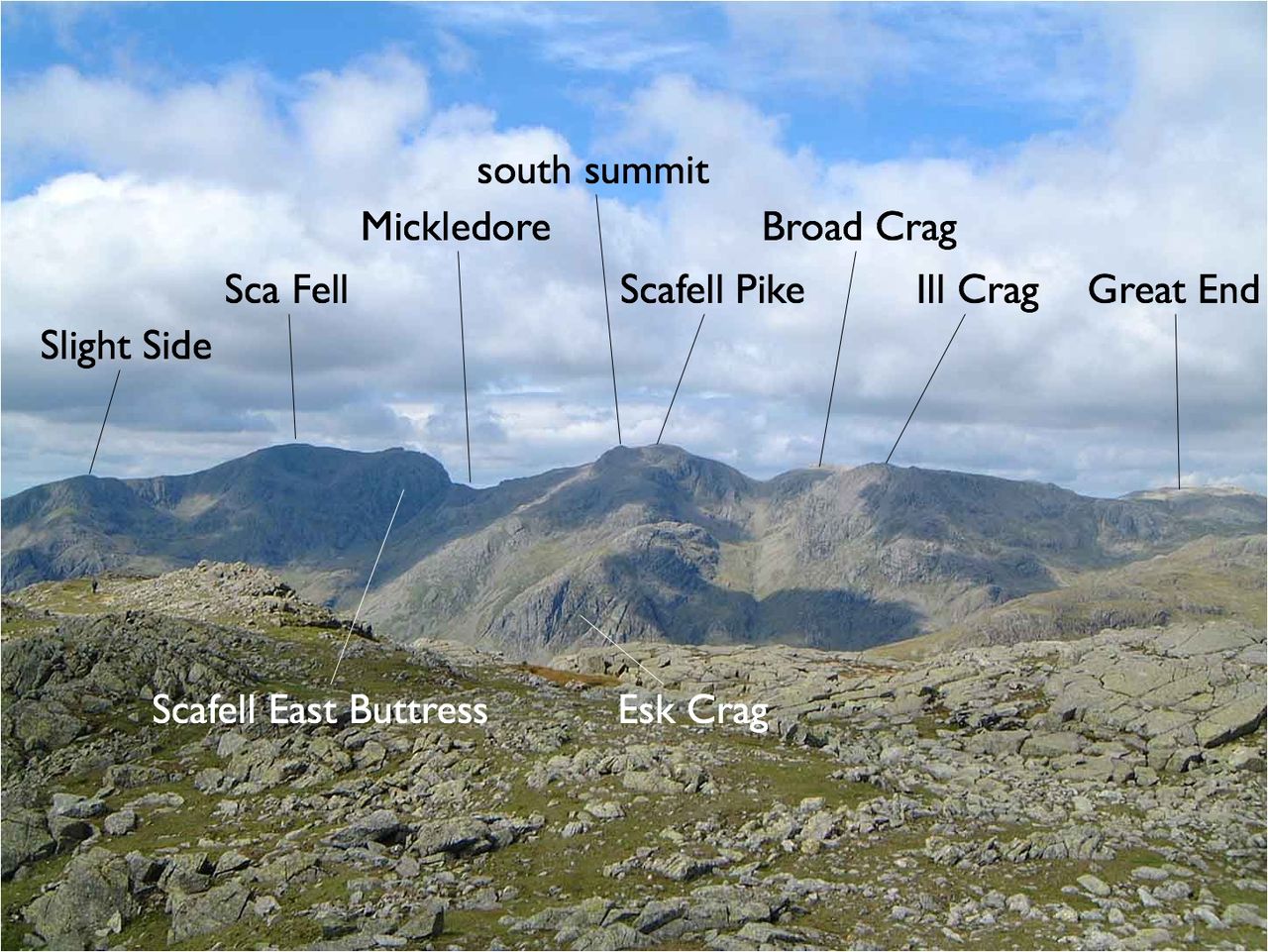
Sca Fell stands in Cumbria’s Lake District, a 964-metre peak between Wasdale and Eskdale. It is England’s second-highest mountain, separated from Scafell Pike by the narrow Mickledore col. The fell’s southern slopes descend smoothly toward Wastwater, while the east side drops in steep crags over Eskdale. Northward, Scafell Crag rises as a sheer wall of rock. The summit ridge runs south from Mickledore past Slight Side, with Great How forming a separate plateau to the southwest. Scafell is worth the journey for its dramatic contrasts and historic climbs. The crags hold famous routes recorded in the Fell and Rock Climbing Club’s book Nowt but a fleein’ thing. Lord’s Rake once offered a scramble to the top, but rock falls since 2002 have made it unsafe. Broad Stand, another breach in the crags, remains a dangerous scramble that has caused many accidents. The mountain’s name shifted from the older ‘Scawfell’ to ‘Sca Fell’ after Ordnance Survey maps adopted the shorter spelling in the 19th century. Visitors find a summit marked by a large cairn on a rocky ridge, with views down to Mickledore and across to Wastwater and the coast. Symonds Knott, the northern top, offers a steep climb with sheer drops on either side. Below Slight Side lies a rough upland dotted with tarns, including Burnmoor Tarn, home to trout, perch and pike. The descent south ends in Lower Eskdale, while the Burnmoor track leads to Green How and quieter approaches. From the summit, the Western Fells and Bowfell appear in clear weather, framing a stark yet grand Lakeland landscape.
Opening hours and admission prices change with the season and are therefore not part of this text. Current details from the operator
Nearby
- Slight Side1.6 km
- Scafell Pike1.1 km
- Broad Crag1.5 km
- Church of St Olaf2.8 km
- Great Gable3.8 km
- Great End2.7 km
QR-Code