📷 Image: Wikimedia Commons
Pendeen Lighthouse
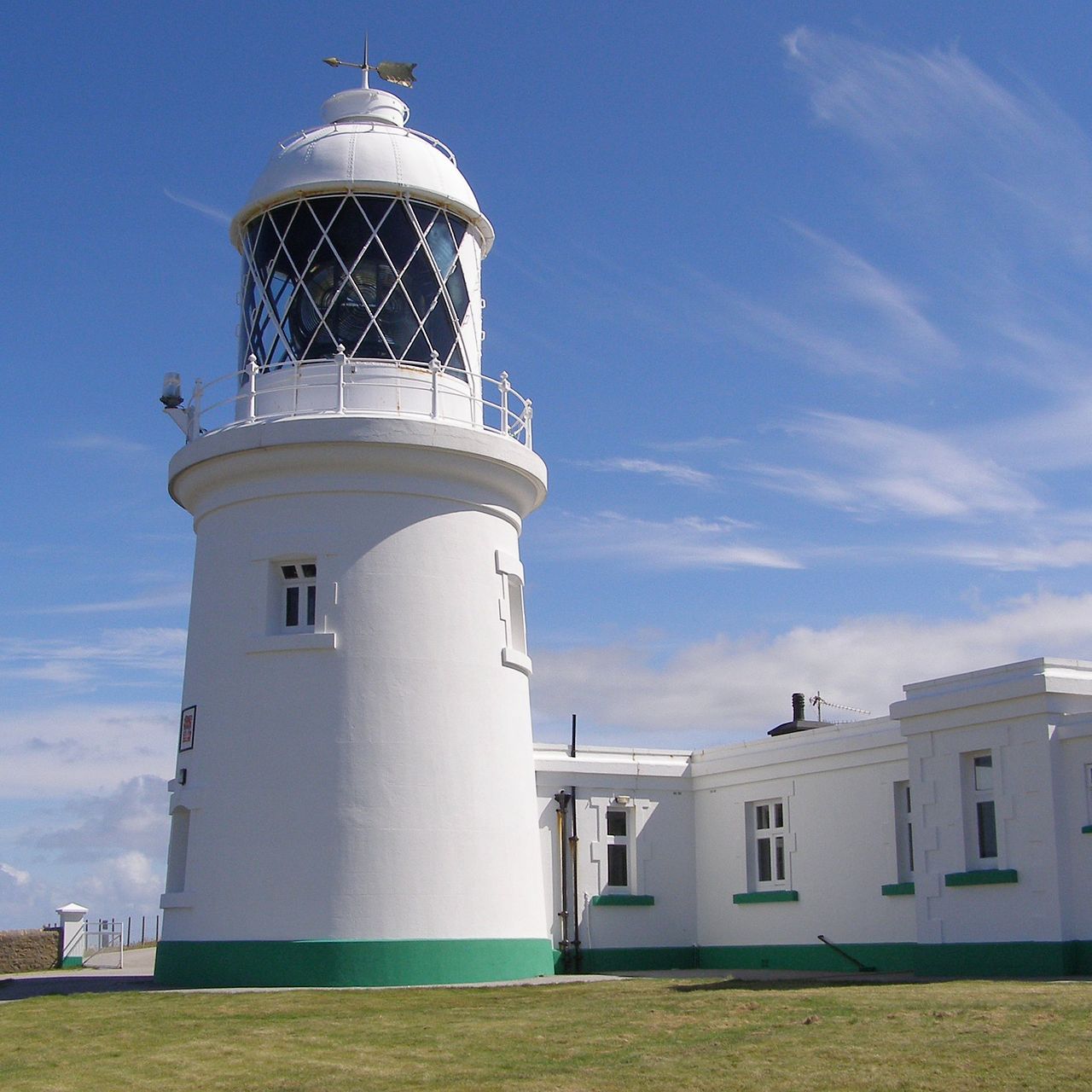
Pendeen Lighthouse stands on a windswept headland two kilometres north of the village of Pendeen in west Cornwall. It is surrounded by protected landscapes: the Aire Point to Carrick Du Site of Special Scientific Interest, the Cornwall Area of Outstanding Natural Beauty and the Penwith Heritage Coast. The South West Coast Path runs along the southern edge of the site. The lighthouse tower rises beside an E-shaped keepers’ block that once housed four cottages. Three cottages sheltered the resident keepers and their families while the fourth provided office space and extra sleeping quarters. Behind the cottages lie three abandoned kitchen gardens, laid out on ground too exposed for crops to thrive. The lighthouse and its adjoining buildings are Grade II listed, including the separate engine house that once housed the fog siren. Sir Thomas Matthews, Trinity House’s engineer, designed the complex in 1891 and Arthur Carkeek of Redruth carried out the construction. The 17-metre tower and surrounding wall were built after Carkeek had levelled the headland. A five-wick Argand lamp first lit the lantern in 1900, but it was replaced six years later by a Matthews mantle lamp. Chance Brothers supplied the first-order rotating optic, which showed four flashes every fifteen seconds and could be seen twenty nautical miles away. Visitors walk past the keepers’ cottages, now holiday lets, to the engine house that once powered the fog siren. The twin 5-inch sirens were later upgraded to a single 12-inch model, the only surviving example of its kind in the country. Inside the tower the original clockwork drive for the lens has been replaced by electric motors, though the massive Fresnel lens still turns on its mercury bath. The engine house now contains a pair of Ruston & Hornsby diesels installed in 1963. Beyond the boundary wall the coast path offers sweeping views across the Atlantic towards the Brisons and Cape Cornwall.
Opening hours and admission prices change with the season and are therefore not part of this text. Current details from the operator
Nearby
- Geevor Tin Mine1.3 km
- Two kerbed cairns 285m north east of Higher Botallack2.8 km
- Kerbed cairn 225m south of Heather Farm2.9 km
- Field system on Truthwall Common3.2 km
- Two barrows on Woon Gumpus Common 700yds (640m) NNW of Boslow Farm3.0 km
- Two large regular stone circles 290m north east of Hailglower Farm3.6 km
QR-Code